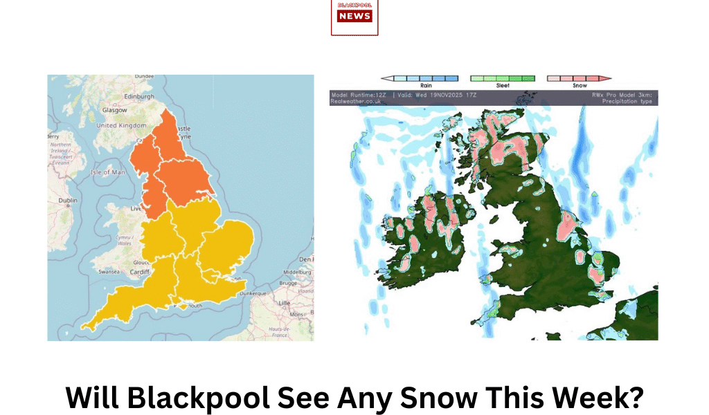
❄️ WEATHER ALERT – Snow Risk Arrives on the Fylde Coast as Coldest Air Sinks South
The region is bracing for a significant drop in temperature as the coldest air of this snap floods south across the UK over the next 48 hours. While the heaviest snowfall is forecast for higher ground inland, Blackpool is positioned perfectly to catch the wintry showers being driven in from the sea.
Here is the essential forecast breakdown for the Fylde Coast:
– Tonight: An area of frontal rain will clear away, paving the way for the much colder air already established across the far north of England. Wintry showers will begin to pick up, and for the North West, this could mean snow beginning to fall even at lower levels.
– Wednesday and Thursday: Showers will become increasingly frequent as the cold air fully takes hold. As a western coastal area, Blackpool will see a bulk of these showers being fed inland from the Irish Sea.
– Snow Risk: The key point for town-centre and Prom residents is that where these showers are most frequent and heavy, the freezing level will temporarily drop, increasing the chance of seeing snow falling to ground level, not just on inland high ground. Expect frequent, sharp, and wintry spells throughout Wednesday and into Thursday.
– Key Message: Blackpool is firmly in the zone for these frequent, coastally-driven wintry showers. While accumulations won’t match those in North Yorkshire (where 25–30cm is possible), residents should prepare for periods of sleet and snow that could impact travel and visibility on the coast.
Stay tuned for more frequent updates!